Day started off with GPS taking us through crazy roads again. Up and down hills in North Adam before we get on Rt. 2. Rt. 2 has this famous hairpin turn that would have been fun if it was not foggy. Monroe state park has no signs (at least from the entrance I picked). Had to follow GPS and assume I was on the right road. The road was pretty bad for unpaved road. It has large gravels that can do some serious damage to the car if I didn't keep the speed down. Not a big deal going to the state forest since it was all uphill.
Before the road turned into forest road, a rottweiler stormed out of the last house toward the car. It was heading toward the rear wheel so I just booked it. Heard a whistle and saw the dog looking at the house in the rear view window as I try to put more distance between me and the dog. Was not a happy camper because I could have accidentally drove over the dog or the dog could have bite a hole in my tire.
Road got more rutted pass this point. There was a "road closed" sign parallel to the road I was traveling on so I was not sure if the sign is for the road I was on or a weird forest road toward nowhere. Was even more confused when I got to where I was supposed to turn toward the parking lot because all I saw was this
A little too rutted for my comfort but I came too far to go home. Scout out the road a little and proceed on first gear. Had to stick close to the bushes to avoid some mud patches and puddles. Couple of rutted parts have big rocks in the middle of the road that could do serious damage if I drive through the middle of. Not a fun start to the trip.

Took a picture of my car before I head to the trails because this area is sketchy with remain of a bonfire and beer cans all over. Wanted to have some pictures with me in case I came back with the car vandalize or worst, gone.

Well, that's a good start to the hike, a down tree in the middle of the trail. The trail is pretty badly maintained with down trees everywhere.
View was not bad at all. DCR built this overlook platform that gave this nice view of the river below. Too bad trees are not budding yet.


Went hiking toward Spruce mountain and never found the vista indicated on the map. The sky cleared out by the time I got back to the parking lot so decided to head back to the overlook again for a better view.

And look! my car is still there and very lacking in any damage. No leaks, no flat tires, and ready to go home. The rutted road was worst than I thought. Car slipped down a rut on the way out. I thought I was done for because the car was leaning forward with both front wheels in the muddy rut. With a gentle nudging of the gas and the car climb out of the rut with no problem. Got home with only some muddy tires.
 A field of flower in front of someone's house


 View from upper fall


 A trail along a stretch of CSX railroad showcasing different bridges used for the rail.


 End of the line. The trail ends with a concrete bridge and an active rail track.
 On the way back, I've noticed this creepy looking thing. Doesn't help that I was listening to a podcast about a manic patient getting shot in the hospital for thinking he is Obama and refuse to listen to the nurses.
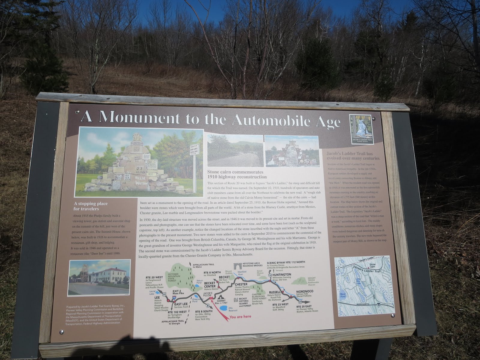
  Of all the scenic byways in NE this one seems the weirdest of them all. Artsy monument in the middle of nowhere